Archive Record
Images
Metadata
Object Name |
Map |
Title |
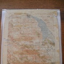
U.S. Geological Survey Map, Petaluma Quadrangle, 1914. |
Date |
1914 |
Object ID |
311.01.018 |
Scope & Content |
MAP, Topographic, U.S.G.S., Petaluma Quadrangle, 1914. Map encompasses Town of Petaluma in the North, and Forbes Railroad Station and Town of San Geronimo to the South. Shows early 1900's alignment of what will become Highway 101. |